
Originally posted by Ralphie
View Post
-
Not all of the posts were paranoid, but you have to admit, most of them were. -
Maybe I read that wrong but what you're saying is it's for communicating with other planets. That's hardcore.
Comment
-
I use it to bootycall your mom.
We're in the studio, stay tuned.----------(click)-------->
Comment
-
Lol.Originally posted by cbscandal View Post

Yes my name is Dang, Don't use in vain
1992 Honda Accord EX (Coupe/Bordeaux/Auto)
1992 Honda Accord EX (Coupe/Bordeaux/H22A MT)
2008 Honda Accord EXL (Coupe/SanMarino/6spd)
Comment
-
If airplanes are other planets, then yes. The range is only up to about 200 miles or so.Originally posted by F22HB View PostComment
-


So how much do pilots REALLY rely on this information? I mean, I know you need your instruments and you probably learn to trust them, but if, for whatever reason, you had to land a plane with no satellite or GPS-type help, could it be done? Could you land a plane only knowing your altitude and speed?

KeepinItClean | EnviousFilms | NoBigDeal | YET2BSCENE | .� ` ' / �. | click here.
Originally posted by JarrettComment
-
You can land without any primary flight instruments if you can see the ground.Originally posted by MikeW View Post
You can use the Earth in place of the instruments, and you can use known power and pitch settings (called the Control/Perfomance method of flying), to get your airspeed.
The instruments are only required in low visibility and bad weather, or IFR (Instrument Flight Rules) or IMC (Instrument Meteoroligical Conditions) flying.
For VFR or VMC (Visual Flight Rules and Visual Meteorological Conditions), you don't need the primary flight instruments at all. The only ones you really use a whole lot in those circumstances are the airspeed and altimeter. You do use the others, but more to back up/monitor what you are seeing outside as opposed to actually control the airplane.
If you were in IMC and lost all of your instruments, then your first priority is to take what little bit of situational awareness you still have and get your airplane to a safe location and altitude so you can procede to an alternate destination that was in VMC, or that you could see out the window. If you lose only part of your flight instruments, then pilots are by legal requirement, trained to be able to fly the airplane with only part of the instruments working. It gets really workload intensive really quick, but can be done. Obviously, as instructors, we challenge our students with worst case scenario training, so that if they were to encounter that in the real world, they would hopefully be able to deal with it. At the very least, they have probably seen something similar before.
People have this misconception that the airplane can't be flown without instruments, mostly because they don't know better. The instruments (for the most part) are only required when the view out the windows is not sufficient to fly the airplane by looking at the ground. Keep in mind that the eariliest airplanes didn't have anything, and then until the 1930's, they pretty much had a compass, and airspeed indicator and an altimeter in some cases.
And yes, the very first lesson of instrument training is to trust your instruments, because you are much more likely to determine your position in space physiologically (inner ear, view out, etc) incorrectly versus your instruments having a mechanical failure. We have ways to determine whether the instruments are working correctly, or are failing and in the new glass cockpits, equipment failures are especially rare because they aren't relying on mechanical parts like the old "round dial" instruments.Comment
-
That's fucking awesome. I love this shit.
KeepinItClean | EnviousFilms | NoBigDeal | YET2BSCENE | .� ` ' / �. | click here.
Originally posted by JarrettComment
-
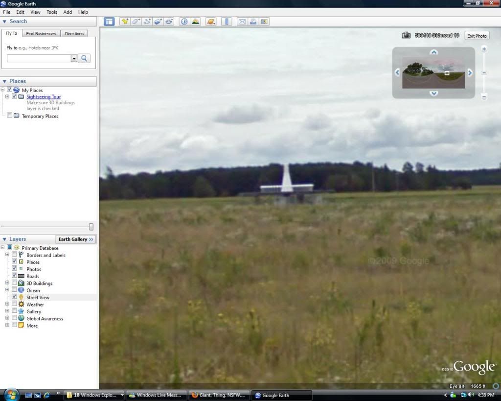
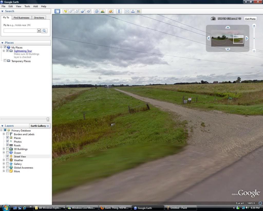
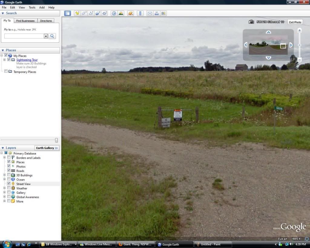
There's one like these near my old house in Ontario. It's in the middle of an open field, like 500 feet off the road. Just a chain link fence around it and a small shed-like out building and an ungated driveway.Originally posted by owequitit View PostComment
-
Ok, Google Earthed the one by my old house. There's houses on the other side of the road from it.
Apparently it's for sale too lol.
 Last edited by crazymikey; 01-06-2011, 07:53 PM.
Comment
-
Yes, these stations dot most parts of the world. Usually, you find them every 50-100 miles though. Also, there are different types, as they aren't all as powerful as each other. They have what are called High VOR's, Low VOR's and Terminal VOR's. Each one is respectively less powerful than the last. The High VOR's are used for longer range navigation, the Low VOR's are used for short range navigation, and the terminal VOR's are typically used for instrument approaches into that airport only, or navigating in the immediate vicinity of the airport.Originally posted by crazymikey View Post
Coincidentally, if you were to look at an aeronautical sectional chart, or an IFR enroute chart, you would see that these VOR's serve as the foundation for our airway system, which is essentially highway routes in the sky. Prior to the advent of GPS, you used to essentially fly from station to station to station to get across the country in bad weather when you couldn't fly from one point on the ground to another. With the advent of GPS, we still use them frequently, but GPS makes more direct routing possible, saving time and money. You will also have a tendency to find special use airspace such as military training routes, restricted areas etc in between the highways.Comment
-
Comment
-
Yea so we got the big 750 ready. Im gonna tear some tree's down if I get caught -Will
-Will

Comment
-
Cool info. Especially since I'm clueless about aviation lol.Originally posted by owequitit View PostComment
-
Who said they hated the governmentOriginally posted by Bcozzi71 View Post . They're pretty shady sometimes. I think that's fair to say.
life is good.Comment


Comment